Gaffneys Creek
Item Number: 2830
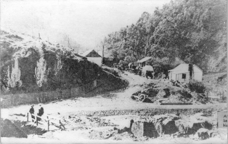
Gaffneys Creek. Gaffneys Creek is a mining locality 47 km. south of Mansfield on the road to Woods Point. The distance by road is much further. Gaffneys Creek is situated in mountainous country, ascending both side from the creek valley. It is at the junction of Gaffneys and Raspberry Creeks. In 1859 Terence “Red” Gaffney from the Big River area east of Gaffneys Creek crossed a range and prospected for gold about twelve kilometres to north of the future Gaffneys Creek township. In the same year two prospectors crossed the range and found rich alluvial gold at Raspberry Creek. More prospectors followed in 1861, bringing in supplies by packhorse form Jamieson. Several villages were created along the creek valley, within the space of a few kilometres. The most northerly was Paradise Point, then Drummond Point, View Point, Raspberry Point and Castle Point. A Government surveyor amalgamated them as one name, Lauraville, after his wife. Lauraville was renamed Gaffneys Creek in 1900. By 1865 each of the four settlements had hotels. Two had a bank or banks and Drummonds Point had a police station and post office. Raspberry Point had a Catholic church, Castle Point an Anglican church and View Point a brewery. A school was opened in 1867. Reef mining rapidly overtook alluvial mining in importance. During the 1870s reef mining became uncertain as owners permitted miners to work the mines without payment, in return for miners keeping the gold from an initial good find. The owners moved back in when the initial find was exhausted. During the 1880s many mines at Gaffneys Creek were paying poorly, except for the A1 mine about five kilometres southwards. It became a long-running success while many of the others to its north were left unworked. During the 1920s the A1 mine’s production collapsed. Thereafter mining continued in the Gaffneys Creek area as new prospects were searched with varying success. The rise in the gold price from the 1934 currency revaluation encouraged the reopening of some mines and improved production came form the A1 mine. A1 Mining Settlement approached the rest of Gaffneys Creek in population numbers. Its school (1903) ran continuously until 1925 and intermittently in conjunction with Gaffneys Creek until 1959. In 1968 the A1 Consolidated Company withdrew from the mine and the equipment was bought at auction by a local syndicate. Within six months the syndicate, Gaffneys Creek Gold Mine N.L., found rich gold which lasted for eight years. In 1980 the Gaffneys Creek village was entered on the Register of the National Estate as a conservation area, comprising a distance of 2.4 kilometres along the winding valley. Most buildings were unoccupied, but represented good examples of gold-era miners’ cottages and stores. Included were a hall, stone retaining walls and a hotel which was burnt down in 1993. The numerous mine workings are approached through thickets of blackberries in some places. Gaffneys Creek was stated to have a population of about 1,000 in Baillere’s Gazetteer in 1865. The census populations were 502 (1871), 274 (1911) and 91 (1954). A population of 5 was stated in the Victorian Municipal Directory, 1994.