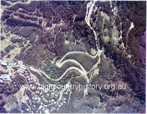
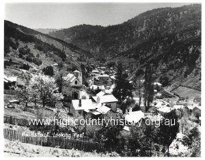
Public meeting re Council amalgamation – Cnr High and Highett Streets. Agricultural High School, Mansfield from With Greetings Postcard Forestry Commission – Mt Stirling Road. Harry Norris and Val Burch both worked on the Mt Stirling Road. Val at back near dozer. PURCELL FAMILY COLLECTION. STEEP TERRAIN NEAR MT BULLER Irene (Rene) Reardon with kangaroo at “Westella” Mansfield. Woods Point – looking west – 1979 Aerial photograph taken in summer showing the hairpin bends leading up to Mt Buller Allen’s Ten Mile Hotel built well before 1908 (situated 10 miles from Jamieson) Brockway truck belonging to Murray Ferrari. Loading a dozer at Mansfield Goods Yard for logging work for Vic Walsh and Tom O’Brien. Church of England, Gaffneys Creek. Snow scene above Falls Creek To the point calendar- Peg Martin IN LOVING MEMORY OF NEVILLE WRIGHT Merrijig Hotel. Ken Stewart and Tom Purcell Township of Woods Point Morning Star Mine, Woods Point 1933 Delatite State School, SS2829 Lane leading to Tom and Bill Cleeland’s farms – Barjarg McKenzie’s Buildings, High Street, Mansfield View of Jericho. Maybe the settlement at Clark’s Flat in the Lilt Valley. « Previous 1 … 299 300 301 302 303 … 316 Next »